Map Search
The Search screen in a FireMapper map is an intelligent search that allows you to search for coordinates, nearby features, addresses and more.
How to perform a location search:
Tap the Search button on the left side of the Map Screen. The search button is only visible when no features are selected on the map
Enter the search text in the text box at the top and tap Enter. This is a list of search suggestions when no search text is entered.
Tap the search result you want to add/view on the map. If the feature does not exist yet, a new point will be added to the map.
Address Search
The address based search requires an internet connect to work.
Examples:
Street Address (e.g. 1 Darley Rd, Manly)
Suburb (e.g. Manly)
Intersection (e.g. Darley Rd Marshall St)
State & Postcode (e.g. 2095 NSW)
Map Feature Search
You can search for features on the current private or shared map by feature type, feature name or feature notes. This is useful for quickly finding an existing feature on the current map.
Examples:
Spot Fire
Photo
Asset
Fire Edge
6 Figure Grid Reference
As six figure grid references repeat every 100km, so make sure you pick the correct location from the result list.
You also provide the UTM Zone (e.g. 56H) and/or digraph to refer to a specific grid reference. 6 Figure grid references repeat every 100km north/south/east/west.
Spaces and dashes in the six figure grid reference are optional.
6 Figure grid references are commonly used by ground based users.
Examples:
242534
242 534
242-534
LH 242534
LH 242 534
LH 242-534
56H LH 242534
56H LH 242 534
56H LH 242-534
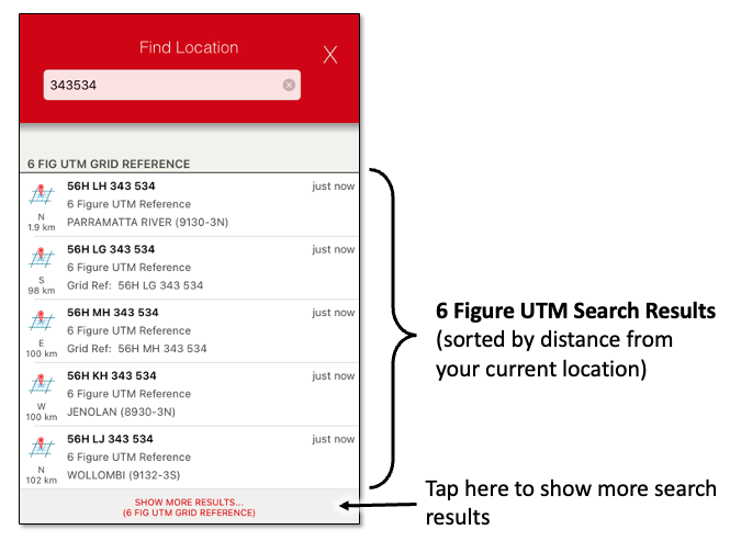
A six figure grid reference has a resolution of 100m by 100m. FireMapper will show the square that the six figure grid reference refers to when the point is selected on the map.
8 Figure Grid Reference
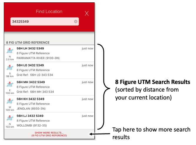
A eight figure grid reference has a higher resolution of 10m by 10m.
When searching using a 8 figure grid reference, you can also provide the UTM Zone (e.g. 56H) and/or
digraph to referer to a specific grid reference. If you don’t provide a UTM Zone or digraph, FireMapper
will return a collection of matching grid references near your location, as each grid reference repeats
every 100km.
Spaces and dashes in the eight figure grid reference are optional.
8 Figure grid references are used by ground based users when a higher level of accuracy is required.
Examples:
34325349
3432 5349
3432-5349
LH 34325349
LH 3432 5349
LH 3432-5349
56H LH 34325349
56H LH 3432 5349
56H LH 3432-5349
10 Figure Grid Reference
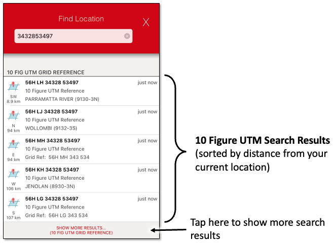
10 Figure grid references repeat every 100km north/south/east/west and has a resolution of 1m x 1m.
The first five digits in the grid reference refers to the easting in metres and the last five digits
refers to the northing in metres. To convert an easting/northing into a 10 figure grid reference, use
the last 5 figures of the easting and the last 5 figures of the northing.
When searching using a 10 figure grid reference, you can also provide the UTM Zone (e.g. 56H) and/or
digraph to referer to a specific grid reference. If you don’t provide a UTM Zone or digraph, FireMapper
will return a collection of matching grid references near your location, as each grid reference repeats
every 100km.
The spaces and dashes in the ten figure grid reference are optional.
Examples:
3432853497
34328 53497
34328-53497
LH 3432853497
LH 34328 53497
LH 34328-53497
56H LH 3432853497
56H LH 34328 53497
56H LH 34328-53497
14 Figure Grid Reference
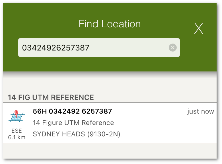
14 Figure references have an accuracy of 1m x 1m. This is a unique location in a UTM zone band (56N, 56S, 55N, 56S etc.).
FireMapper will use the current device location to determine the current UTM zone to use.
In a 14 Figure reference, the first 7 figures is the easting and the last 7 figures is the northing. In order to have 7
figures for the easting, a zero is is added at the start of the easting to get 14 figures.
The leading 0 is optional when searching for using a 14 Figure Grid Reference.
Examples:
03424926257387
03424926-257387
0342492 6257387
3424926257387
3424926-257387
342492 6257387
Easting/Northing
A easting/northing is used to unqiuely identify a location inside a specific UTM zone. FireMapper will use your current
location to determine the UTM zone, if only a easting and northing are provided. Sometimes an easting is written with a leading 0.
Examples:
[Easting] [Northing]
398 313, 6 260 424
398 313,6 260 424
398313, 6260424
0398313, 6260424
0398313E, 6260424N
0398313 E, 6260424 N
0398313 mE, 6260424 mN
0398313mE, 6260424mN
398313, 6260424
0398313 6260424
0398313E 6260424N
0398313 E 6260424 N
0398313 mE 6260424 mN
0398313mE 6260424mN
0398313,6260424
398313,6260424
398313E 6260424N
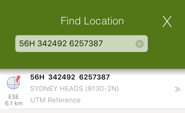
UTM Reference
A UTM reference has a high accuracy of 1m x 1m. This is a unique location which refers to a single location on the Earth’s surface
Examples:
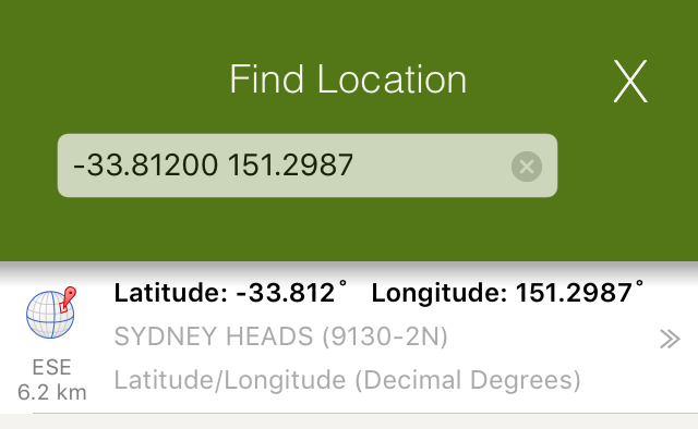
Decimal Degrees (DD)
Latitude/Longitude expressed in decimal degrees. This is a unique location which refers to a single location
on the Earth’s surface. Latitude/Longitude is commonly used by aircraft as they have to operate over long
distances and can easily be entered by the pilot.
Examples:
[Latitude] [Longitude]
-33.81200 151.2987
33.81200S 151.2987W
S33.81200 W151.2987
-33.81200° 151.2987°
33.81200° S 151.2987° W
-33.81200deg 151.2987deg
-33.81200d 151.2987d
Degrees Decimal Minutes (DDM)
Latitude/Longitude expressed in degree decimal minutes. This is a unique location which refers to a single location on the Earth’s surface
Degrees Minutes are commonly used by aviation users in Firefighting. Latitude/Longitude is commonly used by aircraft as they have to
operate over long distances and can easily be entered by the pilot.
Examples:
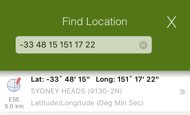
Degrees Minutes Seconds (DMS)
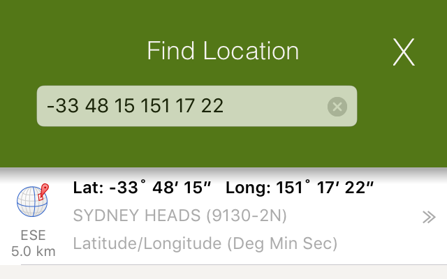
Latitude/Longitude expressed in degree minute seconds. This is a unique location which refers to a single location on the Earth’s surface
Examples:
[Latitude] [Longitude]
-33 48 15 151 17 22
-33d 48m 15s 151d 17m 22s
-33deg 48min 15sec 151deg 17min 22sec
33 48 15S 151 17 22W
S33 48 15 W151 17 22
-33 48 15.11 151 17 22.34
33 48 15.11S 151 17 22.34W
S33 48 15.11 W151 17 22.34
NTZM Coordinates
If your device is located in New Zealand, you can also search by NZTM coordinates. NZTM coordinates
are commonly used by emergency services (including FENZ). NZTM is also used when working with NZ
topographic maps.
You can search for 4, 6, 8, 10 and 14 grid references in NZTM. The FireMapper app will show results for
NZTM coordinates before UTM coordinates, as this NZTM coordinates is the most common format for NZ.
Examples:
95 08 (4 figure grid ref)
957 083 (6 figure grid ref)
9572 0838 (8 figure grid ref)
95721 08381 (10 figure grid ref)
1795721 5708381 (NZTM coordinates)
Quadrillage Romer Reference
If your device is located in Quebec, you can also search by the quadrillage romer grid that is
used in Quebec. This grid format is used by emergency services in Quebec.
Examples: