Shared Maps Table

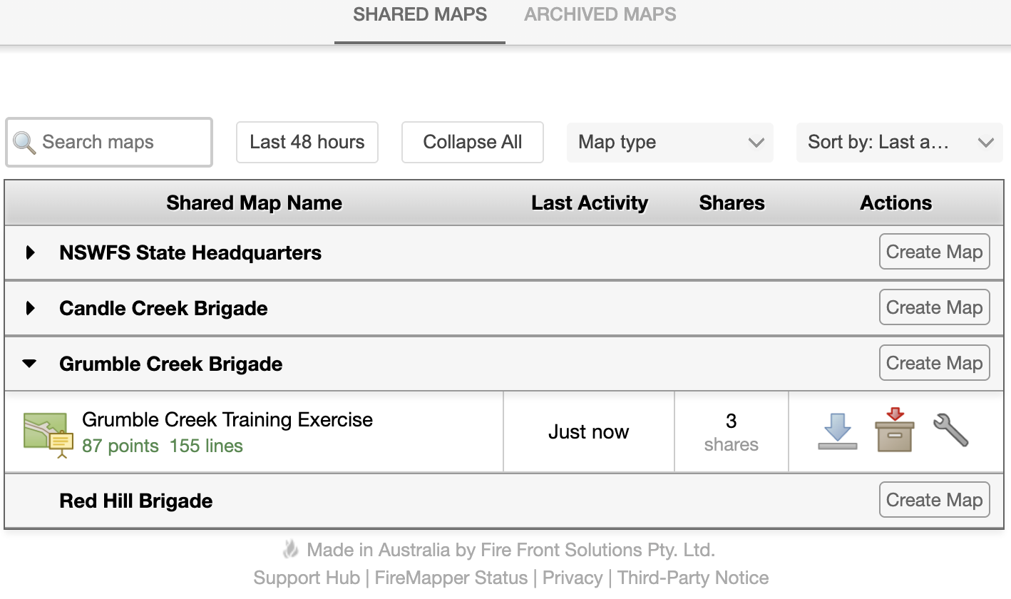
All the shared maps that you have access to are listed in the Shared Maps Table. The table can be filtered and sorted based on time, name, type, and feature count.

If you have access to multiple groups within your organisation, you will see multiple sections in your Shared Maps Table. Click on a map to open it in the Map Viewer.

../_images/list.png

download Download Map: displays multiple formats to download the map in including KML, KMZ, GPX, GeoPDF and Compressed Zip Folder.

archive Archive Map: moves a map into the archive, meaning it is no longer visible in the FireMapper shared map lists.


Map Properties Dialogue

map_properties All map management is done through the Map Properties dialogue. The following properties can be set for a map:

../_images/map_properties_dialogue.png
  • Map Name must be at least 5 characters long and can only contain letters, numbers, and spaces.

  • Map Type can be set. The following map types are available:

    • Fire Incident

    • Storm & Flood Incident

    • Search & Rescue

    • Training / Exercise

    • Hazard Reduction

    • Pre-incident Plan

    • Data Collection

    • Police Operation

    • Other

  • Map Tokens are a quick solution to grant anyone temporary access to the map. Read more…

Note

Additional map properties are available. Contact us to set these up:

  • Map Streaming allows real-time automatic pushes of all map edits into your GIS systems.

  • Delete Map allows you to permanently delete a map. This cannot be undone.


Intra-agency Sharing

If your profile has a FireMapper hierarchy set up, you will see an Intra-agency Sharing option in the Map Properties dialogue. Intra-agency Sharing adds other groups within your organisation to the map.

FireMapper Hierarchy

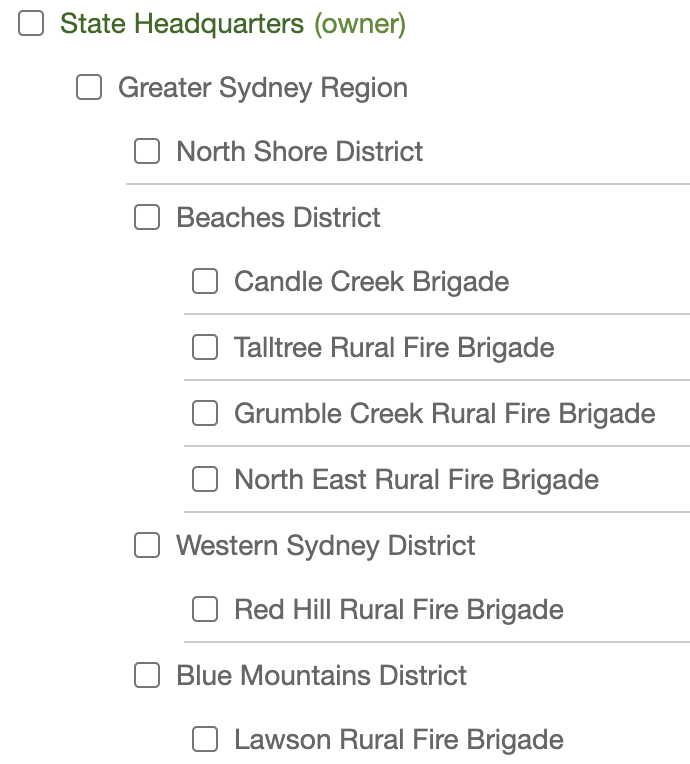
The FireMapper hierarchy is a way to organise your agency’s users and maps into a tree-like structure, typically defined by region or function. This separation ensures that users only see maps that are relevant to them, resulting in a cleaner and more organised Shared Maps experience, as well as increased organisational responsibility at more local levels.
../_images/hierarchy.png ../_images/hierarchy_maps.png

Note

Separate subscriptions can be linked together to form one hierarchy and thus streamline map sharing.

Using Intra-agency Sharing

To share maps within across the FireMapper hierarchy, select the Intra-agency Sharing option in the Map Properties dialogue of the map of interest. Then, tick the groups you want to share the map with. You can select multiple groups, or even the top-level group to share with all users in your hierarchy. Changes are applied instantaneously and reflected in the Shared Maps list of FireMapper users on their devices and in the Portal.

../_images/intraagency.png

Live Layers

An existing FireMapper Shared Map can be transformed into a Live Feed. This means that the mapped data in the map will be displayed as a read-only overlay on all other maps.

This allows you to easily create and manage authoritative datasets in FireMapper, and also view them in FireMapper.

Live Layers can be toggled on and off—as with existing Live Feeds—allowing you to maintain a clear operational picture in your operational Shared Maps.

../_images/live_layer_map.png

Enabling Live Layers

To set a Shared Map as a Live Layer, open its Map Properties dialogue and tick “Enable Live Layer”.

../_images/live_layer.png